Trek Upper Mustang and Saribung Peak (6330m) climbing

Price fromUS$ 3,975.00
Quelques repères
3 - 4 personne
US$ 3,975.00
5 - 6 personne
US$ 3,700.00
Book This Trip
Trip Facts
  • Duration 22 Days
  • Destination Nepal
  • Difficulty Level Strenuous +
  • Max Altitude 6328m.
  • Trip Start and End Kathmandu
  • Best Season July - September

Trek into Hidden treasures of Upper Mustang and Saribung Peak (6328m) climbing

The lately explored trekking route in the remote Mustang region, covering Mustang, Saribung Peak (6328m.), and the Naar Phu Valley, is an attractive three-week-long trek in Nepal. The adventurous and strenuous Saribung trek is the prime attraction situated between Mustang and the Naar Phu Valley. This stunning trekking route mostly follows the high  route of the Mustang region. Crossing the former kingdom of Mustang is already a superb trekking experience with its characteristic landscapes."
Get Way to Upper Mustang_Kagbeni

The purpose of the vary trek is to provide three interesting trekking destination at once. Hidden treasure Mustang, beautiful snowy peak Saribung and old world mystique valley of Naar Phu Valley. Crossing the Kaligandaki River, and reach to Lo Manthang, trek pass through incredible landscape and wildlife creature, appearance of Damodar Kunda and glacier over there add inspiration in your trip long and attractive of Mustang and Saribung peak. Saribung Peak is easy and normal to climb.      
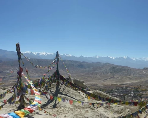
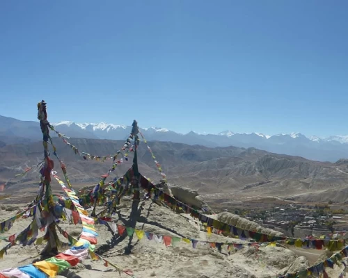
Nyila pass Mustang with a prayer flag

The route is quite interesting, where you start trekking from Pokhara. You pass the well-known trekking destination of Nepal like Jomsom, Damodar Kunda (Damodar Kunda is the sacred holy place for both Hindus and Buddhist, thousands of devotees of Lord Shiva take participate in the fair which has held in September/ October). Generally we follow the domestic airlines to reach Jomsom but if whether condition barrier to the flight we have to walk to get Jomsom. The road along the way is not like normal as other route. You should walk through muddy, sloppy, congested, and narrow path. The trail is completely clay built.  


Itinerary

ExpandCollapse
  • Accommodation Hotel
  • MealsFree
  • Max Altitude1340m.

Preparation for the trek permit, as the upper mustang and Nar Phu valleys are the restricted area and Briefing for the Saribung peak expedition at department of tourism, afternoon preparation and final check the equipment.


  • Accommodation Hotel
  • MealsB
  • Max Altitude1340m

 Kathmandu- Pokhara highway (prithivi highway) is 200km long, we follow the Trishuli River up to Mugling and we follow the Marshyandi River up to Dumre to the North West direction and reach to the pokhara. We can have chance to see the adventure of rafting floating over Trishuli River. We stop for the lunch on the way Kathmandu to pokhara. We conduct short sightseeing tour of Pokhara valley.


  • Accommodation Hotel
  • MealsBLD
  • Max Altitude900m

Wake up early in the morning and depart to Jomsom by flight; the flight is very impressive between the Annapurna and Dhaulaghiri. The village of Jomsom and its Tibetan architecture will attract us. The wind blow strong in the bed of the Kali Gandaki River so, Walking in the windy and the dusty atmosphere we reach to the oasis of Kagbeni which is the gate of upper Mustang. We will Visit the monastery of the village.

  • Accommodation Lodge
  • MealsBLD
  • Max Altitude2800m.

Check our special permit at check point in Kagbeni before entering Upper Mustang. We will transfer by jeep to avoid the dusty gravel road along the Kaligandaki riverbank up to Chhuksang. The road gradually ascends to Chele, Ghiling, and Ghami. During the journey, you can descend to visit various monasteries and Chortens. Additionally, you will be treated to incredible views of the Nilgiri range and Tilicho peaks (7135m) from Nyi La Pass (4000m) and along the way up to Ghami.

  • Accommodation Lodge
  • MealsBLD
  • Max Altitude3520m.

The path leads us up towards the high plateau over Morangla Pass (4125m), offering a magnificent view of the Mustang plateau. Moreover, we can explore the red hills and ancient Tibetan houses on the way to Drakmar. Now, the trail gently descends towards Tsarang via Ghargompa and the Marang village.

  • Accommodation Lodge
  • MealsBLD
  • Max Altitude3620m

Here, we traverse through an increasingly dry landscape, encountering more plateaus with some undulating trails. After 4 hours of walking, we reach Lo La Pass (3900m), providing a panoramic view of the fortified city of Lo Manthang, which dominates the ancient fort with Tibet visible on the horizon. Upon arriving in Lo-Manthang, the royal capital of Upper Mustang, we enter into the Forbidden City.

  • Accommodation Lodge
  • MealsBLD
  • Max Altitude3790m

We explore and visit the ancient monasteries Thugchen (Grey Monastery) and Namgyal (Red Monastery), as well as Thinkar (The Summer Palace) in the western valley, and Nyphu and Graphu in Chosar valley. Due to the considerable distance between these sites, it is recommended to hire a horse for each person for efficient exploration within the limited time. In this area, visitors also have the opportunity to meet the King of Mustang by paying a designated entrance fee.


  • Accommodation Lodge
  • MealsBLD
  • Max Altitude3790m.

The trail ascends slowly up to the pass at 4100m and then descends steeply to Dhi (3250m). This area is quite dusty, and dust kicks up automatically with each step. After crossing the suspension bridge, the trail gradually ascends to Yara, a small village inhabited by Tibetan people.

  • Accommodation Lodge
  • MealsBLD
  • Max Altitude3700m.

We climb the entire day along a steep path towards Gyuma Thanti. Today's ascent takes us to 4900 meters (the first pass of the trip). From the lap of this cliff, we can witness spectacular views of the deserted land of the Mustang valley and its many nooks and corners. Following the ascent, we descend approximately 200 meters in elevation to reach Gyuma Thanti.
 

  • Accommodation Tent
  • MealsBLD
  • Max Altitude4705m.

Trek in a dry landscape, we climb gently and cross a 5010m pass, along with great view of Dhaulagiri 1 (8167m) and 2 (7751m) + Tukuche Peak (6920m) are amazing outlook.
After the pass, a long descent leads us to the camp at the bottom of a gorge in a canyon of Pa Khola.
 

  • Accommodation Camping
  • MealsBLD
  • Max Altitude5010m/4800m

After breakfast, we continue to climbing toward a 5500 meters then to Damodar Kunda. En route, we will be captivated by the fresh air coming directly from the Damodar Himal range. During the trek, there's a chance to catch sight of the Damodar Himal range before descending to the elevation of 4900 meters at the Damodar Kunda camp.
 

  • Accommodation Camping
  • MealsBLD
  • Max Altitude5500m./4900m

The trail follows the flank of the hill, ascending through a steep path up to Bhrikuti Base Camp. As we enter the base camp region, we trek through hills and ridges, with the opportunity to encounter some moraine near the base camp. After 3-4 hours of walking, we reach Bhrikuti Base Camp, where we take a rest and keep our climbing gear on standby.
 

  • Accommodation Camping
  • MealsBLD
  • Max Altitude5235m

Today is a dedicated acclimatization day, allowing our bodies to fully adapt to the altitude and atmosphere.
 

  • Accommodation Camping
  • MealsBLD

From Bhrikuti Base Camp, we ascend for 3 to 4 hours along a rocky path towards the High Camp. During the trek, there is a chance to witness numerous snowy summits in front of us. Continuing along the sloping moraine and glacier, as we approach the high camp, we cross the ice glacier and finally reach the camp for an overnight stay.


  • Accommodation Camping
  • MealsBLD
  • Max Altitude5735m

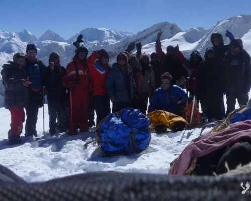
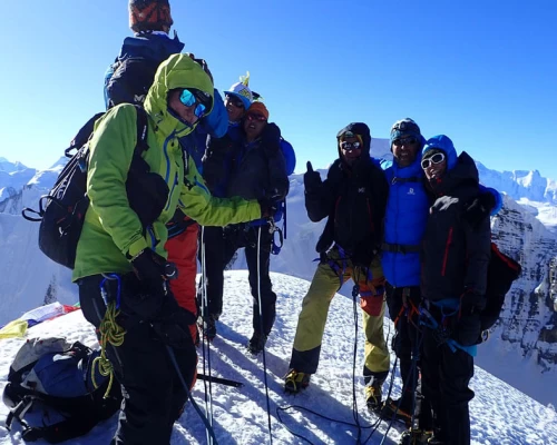
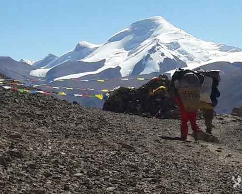
Early in the morning, we set out for the summit, crossing the Saribung Pass. After approximately 2 hours and 30 minutes of ascent, the climber members ascend toward the summit from the pass, a journey that takes about 1 hour and 30 minutes to 2 hours. Meanwhile, the crew members continue to move down to the northern Bhrikuti Base Camp. From the Saribung summit, there is an opportunity to enjoy a panoramic view of Khumjung Himal (6699m), Chhib Himal (6581m), and many more summits.
 

  • Accommodation Camping
  • MealsBLD
  • Max Altitude6328m./4800m

After breakfast at the camp, we descend along a sloping path along the edge of Phu Khola. During the trek, we can admire the beauty of the Phu Valley and the surrounding ridges and hillocks. We continue our journey until we reach Phu Gaun.


  • Accommodation Lodge
  • MealsBLD
  • Max Altitude4000m

After having breakfast in Phu Gaun, we proceed towards Meta. On this day, we have the opportunity to observe geographical variations and an interesting landscape, similar to what we've seen in the previous days. We trek along the edge of Phu Khola, passing through Kyang village (inhabited only in winter by people and their animals like horses, yaks, sheep, etc.), and then continue towards Meta, surrounded by juniper forests.
 

  • Accommodation Lodge
  • MealsBLD
  • Max Altitude3500m.

We will be heading toward  Koto (2600m), passing through pine and juniper forests. Continuing along the edge of Phu and Nar Khola, we notice a gradual decrease in elevation, with the day offering views of the lush greenery of the high hilly region. The narrow paths in this area provide immense pleasure. We arrive in Koto in the late afternoon, a junction of the Annapurna classic route and the Nar Phu trek, situated at the confluence of the Marsyangdi and Nar Phu Khola rivers, where the police check post will verify our permits. If time allow as us, we celebrate our last day party together with crew members and local staff/porters.

  • Accommodation Lodge
  • MealsBLD
  • Max Altitude2600m

Today is the last day of the trek. We travel on a bumpy gravel road for the first section, covering about 65km, which takes approximately 5 hours. Then, we travel by reserved bus to Kathmandu. We find ourselves back in the lush, semi-tropical middle hills of Nepal.


  • Accommodation Hotel
  • MealsBL
  • Max Altitude1340m.

D-briefing and reporting regarding the expedition at Tourism Department

  • Accommodation Hotel
  • MealsB
  • Max Altitude1340m

(Departure time from hotel will be fixed as per your flight schedules for the return)


    Not satisfied with this regular itinerary?

    Are you thinking to plan your custom trip now.

    Included
    • Transfer:  Airport / Hotel pick up & drop by private car/van as per group size.
    • Transportation: Kathmandu/Pokhara travelling by tourist bus and Koto/Besishahar/Katmandu traveling by private reserve bus/jeep
    • Full board basis during the trekking in tent, camping equipment will be provided such dining tent, foam mattresses and all cooking and kitchen gear, meals will be prepared by our kitchen staff (Breakfast, Lunch, Dinner, Tea and coffee.),  (Except beverage).
    • An Experienced & Professional well-trained mountaineering  English speaking guide
    • Entry permit for Annapurna Conservation Area Project (ACAP), Entry permit for Mustang and Nar Phu area
    • Royalty of Saribung peak
    • First aid kit will be available during the trek.
    • All personal gears and group equipments will be carried by porter
    • Nepalese crew Insurance.
    • Domestic airport taxes.
    • Decompression chamber ( Gamow Bag)
    • Satellite phone
    • Re-confirmation of Int'l plane ticket
    Excluded
    • Meals in Katmandu (Near about € 10 – 15 per day/person)
    • Nepal entry Visa Fee (You can obtain a visa easily upon your arrival at Nepal ’s Airport in Katmandu).
    • International Airfare and Airport Taxes.
    • Entrance fees in the Historical site /Monument at KTM.
    • Any kind of Alcoholic, hot and cold drinks or bar menu.
    • Personal trekking/climbing Equipment, travel and medical insurance & helicopter in case for emergency Rescue evacuation, personal expenses,
    • Any expenses caused by reason beyond our control such as roadblock due to natural climates and accidents and unforeseen events etc…
    • Tips and Gratitude.
    Additional Information

    Our itinerary has been designed to avoid minimum the graveled and dusty road along the Kaligandaki riverbank up to Lo-Manthang. We will transfer by jeep from Kagbeni to Ghami, but you can request stops to visit various monasteries, chörtens, and landscapes to capture some nice photos during the journey.

    Related Trips