Trek Annapurna region
Trek in the Annapurna region| Annapurna circuit
The Annapurna circuit is a world-renowned trekking destination with an iconic range of the Annapurna Massif. This 55km (34 miles) Stretch of mountains is the showpiece of the mighty Himalaya circumnavigation. The journey passes through a thrilling array of eco-diversity and cultures.
The heart of it all is Annapurna I, (8,091m) ( 26,545ft) ranked as the world’s 10th highest mountain and the first peak over 8,000m to have been scaled.
The trek’s usual starting point is in the lowlands with lush sub-tropical scenery near the Marsyandi River. The route gradually ascends to its high point of Thoranga la (5,416m) (17,769ft). Along the way around, astonishing scenery includes a dazzling array of peaks and the varied and diverse people that make it a culturally rich experience.
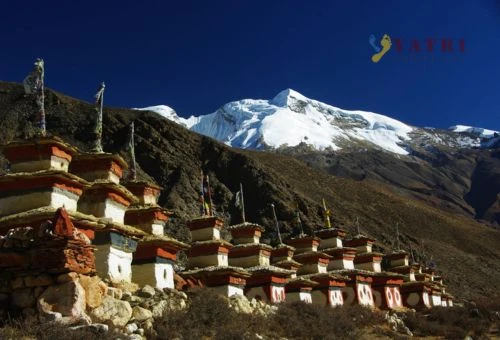
On the way, you will cross the deepest gorge in the world, Kali Gandaki, cut by the river between two giant mountains Dhaulagiri (8167m) and Annapurna (8091m). As you walk up and down along the river valleys including Marshyangdi, you will witness the scenic beauty of gilded paddy fields in the fall and thick blooming rhododendron forests in the springs.
Another option is taking an early morning spectacular flight down to Pokhara from Jomsom through the huge mountains of the Annapurna and Dhaulagiri ranges tower above us as
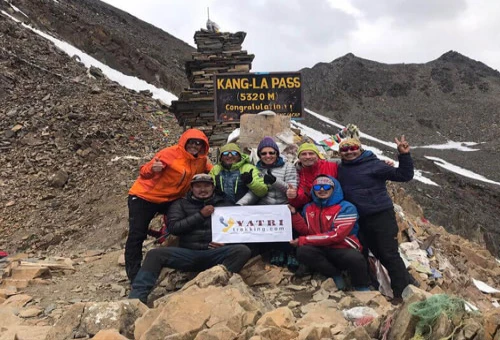
The trekking itinerary can be extended to Tilicho Lake (frozen lake) from Manang, situated at an altitude of 4900m and also lies on the way. This side trip to Tilicho lake can be reached in 2 days through a remote landscape away from the main circuit trail but it is noted that beyond Siri Kharka the trail can be difficult if not treacherous, especially under snowy conditions.
Physical Condition & practical Requirements:
Trekking in the Himalayas Nepal or high land requires a normal level of physical fitness or 5 - 7 hours of walking per day. Unlike on ascending peaks, trekkers do not have to go through any technical difficulties. The walking duration is planned in such a way that the trekkers have enough time to explore the region and its people without any physical exertion.
Our itineraries are categorized according to the level of difficulty and the duration of the day. The schedules are given for information only but are subject to change the journey slightly from one year to another, especially depending on the finding of fresh water on spots for the camp trek and any circumstances.
Peoples and ethnic groups of the Annapurna region
The Annapurna region is inhabited by various ethnic groups, the Gurung constitute the major ethnic group, mostly inhabiting the middle hills like Ghandruk, Sikles, and Ghalegaon are the main Gurung cluster. The Magar mostly occupy the lower land of Kaligandaki Valley, while the Thakali are their northern neighbors. In the peripheral areas live various other groups, including Brahmins, Chhetri, Newars, and Kami…
Climate and Temperatures of the Annapurna region
The monsoon is almost everywhere in Nepal from mid-June to the end of September, apart from Dolpo and Mustang however the upper part of Manang and Nar Phu valley are also the rain shadow area as the cloud flowing from the south is blocked by the Himalayan range. So, trekking can be organized in this area even in summer.
Access to the Annapurna circuit trek
The road infrastructure development movement is across the country, the Annapurna circuit could not be an exception. Before road construction along the Annapurna circuit, the journey was 215km or takes about 3 weeks to complete the circuit. Now the road gives trekkers a flexible choice of elongating or shortening with different start/finish points along the way e.g. Jagat, Dharapani, or Chame, and stop at Jomsom or Beni. There is about 200km of blacktop road to Besishahar from the capital city of Kathmandu or Pokhara. Thereafter the road is still under construction/Graveled, and the yearly monsoon remains, which requires constant maintenance.


.webp)