Annapurna circuit and Tilicho lake with Mesokunda pass

Trip Facts
  • Duration 16 Days
  • Destination Nepal
  • Difficulty Level Strenuous +
  • Max Altitude 5100m
  • Trip Start and End Besishahar - Jomsom
  • Best Season Oct-Nov, Mar_Mai
Highlights

can views of Annapurna Range, Dhawalagiri( 8167m), Poon Hill (3200 m.), Mt. Machhapuchhre (6997m), world’s deepest gorge, Kaligandaki Gorge (6967m), sacred Muktinath temple and Muktinath valley and KaliGangaki valley.


Annapurna circuit with Tilicho Lake and  Mesokunda pass (5100)

Annapurna Circuit will take you to Tilicho Lake which is situated at the highest altitude in the world at 4919m. We cross the Mesokunda Pass (5100m) after we leave Tilicho Lake to reach Jomsom. According to Hindu Mythology, Annapurna means a goddess of abundance in South India. Today, the word ' Annapurna' has its meaning linked to a mountain range with some of the top summits of the world and the region around it, renowned for trekking and expedition. One of the most popular trekking destinations, Annapurna Circuit offers spectacular views of the Himalayas. Trek in the Annapurna circuit is one of the most adventurous treks in the world that can be extended for more than a month for ardent trekkers. And Annapurna circuit trek has something new to offer each day of the trek, with varied levels of landscapes and diverse cultural experiences with various mountain tribes. On the way, you will cross the deepest gorge in the world, Kali Gandaki Gorge (6967m), cut by the river between two huge mountains Dhaulagiri (8167m) and Annapurna (8091m). Tilicho Lake situated at an altitude of 4919m also lies on the way of Annapurna.  As you ascend and descend along the river valleys including Marshyangdi, you will get a glimpse of the scenic beauty of gilded paddy fields in the fall and thick blooming rhododendron forests in the springs.    


Itinerary

ExpandCollapse

The trip/trekking itinerary detailed day by day is always with you. During the trekking, we always bring safety measures and a first aid kit. At the high altitude, we strongly recommend proper acclimatization. We designed the itineraries with special attention and being careful, but due to the local weather conditions, natural disasters, and other factors that are beyond our reach, if this is the case the trek leader will do everything possible to work out the changes to the itinerary in order to minimize your inconvenience.


  • Accommodation Hotel
  • MealsFree
  • Max Altitude1340m
  • Accommodation Hotel
  • MealsB
  • Max Altitude1340m

The Kathmandu Besishahar is 185km. The long road led by the Prithvi Highway up to Dumre and connected by the Bhanubhakta Highway to Besishar. We follow the Trishuli River up to Mugling and after we cross the Mugling we follow the Marshyangdi River along with the view of Annapurna massif, Ganesh Himal, and Manaslu. We can have a chance to see the adventure of rafting floating over the Trishuli River. We change our vehicle at Besishahar and then travel by local jeep about 35km to Tal or Dharapani
The recent under-construction road condition is quite narrow & graveled between Besishahar and Manang. Sometimes you may need to change your vehicles several times cause of landslides and other circumstances. (Also the bumpy road may make your trip slightly boring.) 

  • Accommodation Lodge
  • MealsBLD
  • Max Altitude1900m

From Dharapani we will ascend gradually up to Bagarchap, which is the Tibetan village from where we start to see impressive views of high summits: Manaslu, Ngadichuli, Lamjung, and Annapurna II. We continue to climb up by the serpent path in the conifers forest, Pines of Himalayas. It is a pleasant journey in the conifers forest (Pines, firs, cedar) with an eye-pleasing glimpse of the massive Manaslu and Lamjumg Himal. We find the first Rhododendrons (flourish in March/ April). Every entrance of the village consists of prayer wheels and flags, and the smell of burnt juniper incense as an offering, which makes warm-welcome to us. The glaciers are closer and the temperature rapidly falls in the night.

  • Accommodation Lodge
  • MealsBLD
  • Max Altitude2700m

We continue towards Brathang, the last village before arriving in the Manang Valley. After walking one and a half hours from Brathang in the Pine forest and after crossing the suspension bridge we are above 3000m, we entered the Manang Valley bordered by the Annapurna II, III and IV, GangapurnaTilicho Peak, Chulu East, West, Fareast, as well as by the Pisang Peak. Our first climbing leads us to higher Pisang where we visit the Buddhist monastery.

  • Accommodation Lodge
  • MealsBLD
  • Max Altitude3300m

We start our walk at a slow pace to acclimate to the altitude easily. Passing through pine open forests, mineral-rich landscapes, and juniper bushes for the last time, after one hour, we cross a suspension bridge, climbing along a winding path. This leads us to Gyaru, another village where the wind can disturb the calm atmosphere, offering an impressive view of the Annapurna range. After two hours of walking along the mountainside, we reach Ngawal, a high-altitude village, where we stop for tonight

  • Accommodation Lodge
  • MealsBLD
  • Max Altitude3600m

This is the acclimatization day. Walk up to the Kangla base camp which dominates the valley, perching at 4500 meters.


  • Accommodation Lodge
  • MealsBLD
  • Max Altitude3600m

After approximately one hour of walking, we reach Braga, where we visit a magnificent Tibetan monastery perched on the village. This monastery, typically Tibetan, is constructed on the mountainside, on a hillock of limestone. After the visit, we trek to Manang village where we will stop for lunch. We then deviate from the main classic trail of the Annapurna Circuit by following the Marsyangdi River until its source, leading to Tilicho Lake. Our overnight stop is at Khangsar.

  • Accommodation Lodge
  • MealsBLD
  • Max Altitude3700m

After breakfast, we ascend gradually, navigating a series of ups and downs along the mountainside trail toward Yekle Bhatti, passing through Shreekharkha. Along the way, enjoy panoramic views of Tilicho Peak (7135m.), Ganga Purna (7454m.), the landslide area of Annapurna III, and sightings of wildlife such as Blue sheep and yak.

  • Accommodation Lodge
  • MealsBLD
  • Max Altitude4100m

The path gradually ascends as we traverse through the moraines, offering views of the Black Rock (7485m) and Khangsar Peak. Tilicho Lake is considered sacred, and according to Hindu legend, it is believed to be the location where the first recitation of the Hindu text Ramayana took place.


  • Accommodation Lodge
  • MealsBLD
  • Max Altitude4900m

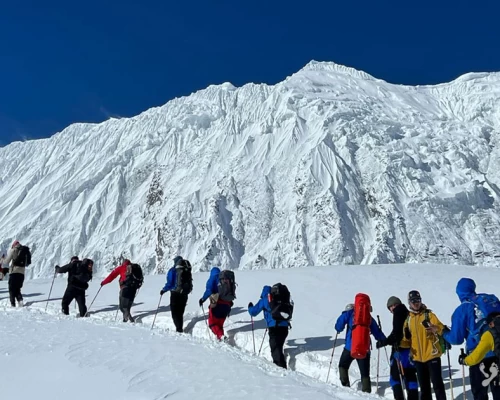
Today marks a challenging and lengthy leg of the trek. We set out early in the morning, first heading towards Tilicho Lake, then ascending to the Tilicho Pass, and progressing further to the Mesokund Pass (5100m). As the day unfolds during the climb, we turn ourselves to behold the unforgettable panoramic view of the massive Annapurnas. We begin the descent towards Yak Kharka, treated to magnificent views of the Nilgiris and the imposing Dhaulagiri (8167m). It's important to note that descending in the winter season can be very risky due to snow and blue icy trails.

  • Accommodation Tent
  • MealsBLD
  • Max Altitude4000m

We descend directly towards the Kali Gandaki valley for about 4 hours, encountering animals such as yak and blue sheep along the way. The landscape undergoes a complete transformation, and during the descent, we'll appreciate the geological wonder of the Mustang region. Now in the Kaligandaki valley (Jomsom), known for its strong winds and predominantly inhabited by the Thakali people. Due to the strong winds during the day, flight services to Pokhara are available only in the morning.


  • Accommodation Lodge
  • MealsBLD
  • Max Altitude2700m

We take an early morning spectacular flight down to Pokhara through the huge mountains of the Annapurna and Dhaulagiri ranges tower above us as


  • Accommodation Hotel
  • MealsBLD
  • Max Altitude900m

Today travelling by private vehicle or tourist bus on to Pokhara/Kathmandu high way (200km)


  • Accommodation Hotel
  • MealsBL
  • Max Altitude1340m
  • Accommodation Hotel
  • MealsB
  • Max Altitude1340m

(Departure time from the hotel will be fixed as per your flight schedules for the return)


  • MealsB
  • Max Altitude1340m

Not satisfied with this regular itinerary?

Are you thinking to plan your custom trip now.

Included
  • Grand transportation:  Airport / Hotel pick up & drop by private car/van as per group size and Kathmandu/Beshisahar-Dharapani traveling by jeep or local bus and Pokhara/Kathmandu traveling by tourist bus/ private reserve bus as per group request.
  • Flight Jomsom/Pokhara
  • Full board meals during the trekking, accommodation in twin sharing Lodges.  (Meals can be choose from Menu) (Breakfast, Lunch, Dinner, Tea and coffee.) (Cold drinks are not included nor hot drinks between three major meals) tent will be using while lodges are not available
  • An Experienced & Professional Government license holder English speaking trained Trekking guide.
  • Entry permit for Annapurna Conservation Area Project (ACAP)
  • New Trekker's Information Management System (TIMS) permit to the trekking region. You are required 2 passport size photos.
  • 4 nights in hotel International Guest House in Katmandu or Similar category on a twin sharing bed and BB basis.
  • One night at tourist class hotel in Pokhara on twin sharing basis with breakfasts
  • First aid kit will be available during the trek.
  • All personal gears and group equipment’s will be carried by porter i.e. (1 porter for 2 clients, one porter carry max 20-25 kg).
  • Nepalese Staffs Insurance.
  • Domestic airport taxes.
Excluded
  • Meals Katmandu and Pokhara (approx US $ 10 – 15 per day/person)
  • Nepal entry Visa Fee (You can obtain a visa easily upon your arrival at Nepal’s Airport in Katmandu), You are required 2 passport size photos.
  • International Airfare and Airport Taxes.
  • Entrance fees in the Historical site /Monument at Kathmandu.
  • Any kind of Alcoholic, hot and cold drinks or bar menu.
  • Personal trekking Equipment, travel and medical insurance & helicopter in case for emergency Rescue evacuation, personal expenses,
  • Any expenses caused by reason beyond our control such as roadblock due to natural climates and accidents and unforeseen events etc…
  • Tips and Gratitude.