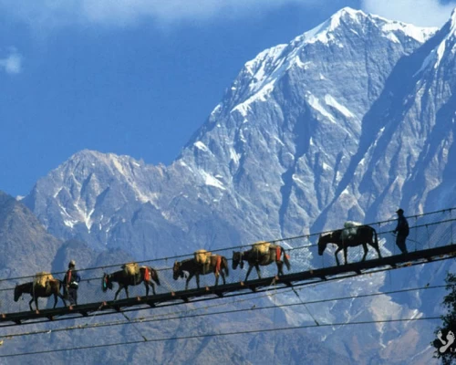
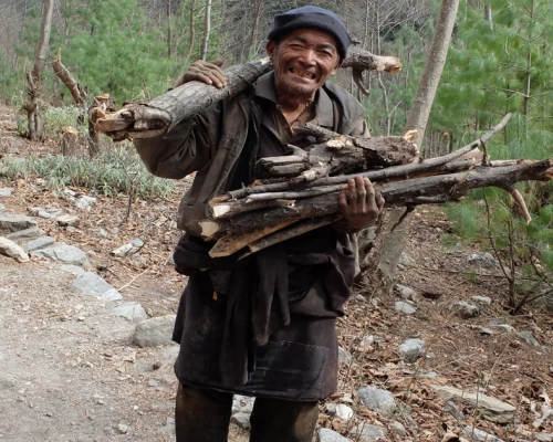
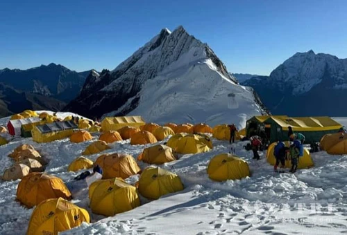
Magnificent great Himalayan massif from Manaslu to Annapurna trek

Trip Facts
  • Duration 27 Days
  • Destination Nepal
  • Difficulty Level Strenuous
  • Max Altitude Kathmandu
  • Trip Start and End Kathmandu
  • Best Season Oct-Nov- Avr- Mai

Magnificent great Himalayan massif from Manaslu to Annapurna trek

The great traverse trek from Manaslu to Annapurna through the upper route of ancestral Gurung villages of Barpak and Laprak. These villages are also known for being the epicenter of the massive earthquake of 2015. Other Gurung villages along the route include Singla and Khorla, where you can immerse yourself in the local culture and interact with the friendly villagers with warm hospitality experiences. The trek begins at Barpak and you will join the classic Manaslu circuit route, at Khorla besi thereafter following the Budigandaki valley up to its source at Larkey La pass.

As your journey following the Budigadanki river up to it source of Tibet border, you'll encounter the warm hospitality of the Gurung and Tibetan communities, each with their own distinct traditions and ways of life. The villages are adorned with prayer flags, ancient monasteries, and traditional homes, providing a glimpse into the rich and fascinating cultures. The mostly people of the low land of Manaslu Annapurna regions are practicing the Hinduism and upper area of the both region peoples are practicing the blend of Buddhism cultural and spiritual odyssey as well. Following the Annapurna circuit is one of the best trekking destinations in the world. Although the road infrastructure is quite threatening, its natural beauty and high Himalayan glaciers are the gem that makes the journey once-in-a-lifetime experience.

Itinerary

ExpandCollapse
  • Accommodation Hotel
  • MealsFree
  • Max Altitude1340m

Free day and preparation for Trek Overnight in hotel

  • Accommodation Hotel
  • MealsBreakfast
  • Max Altitude1340m

Depart early in the morning to destination of Gorkha - Barpak about 133km in tarmac road and about 50km is gravel and bumping narrow road, your lunch at a local restaurant on the way to Barpak

  • Accommodation Lodge
  • MealsBreakfast/Lunch/Dinner
  • Max Altitude1900m

The first day of our trek starts with a picturesque climb along with a spectacular view of Bauddha Himal at the backdrop and the scenic Barpak village looking back down. At the end of the climb, the path goes through an open forest of rhododendrons. The rhododendrons blooming brilliantly in March/April make them more enthusiastic. Once we arrive at the top, we can experience an extraordinary view of Bauddha Himal, Shringi Himal, and Ganesh Himal if the weather is clear, and then later descend towards the village of GURUNG, Laprak, by walking through the stone staircase in the flank of the mountain.  

If time permits us, we visit the honeycomb Gurung village and explore the lifestyle, tradition, and culture of this region. The village consists of more than 500 houses and the number of inhabitants is nearly 3000.

  • Accommodation Lodge
  • MealsBreakfast/Lunch/Dinner
  • Max Altitude1900m

Today is quite long day, walking through the beaten track up and down hill trail. In the morning our trek starts trough terrace fields and stone staircase up to Jyarbu khola and cross the suspension bridge over it and gentle climb up equally we have descend from Laprak through the mountain trail. We move towards the others Gurung villages "Singla, and Khorla gaon.  The trail goes steep down from Singla to Khorlabensi. We will have spectacular view towards Ganesh Himal range but a bit hard on the knees due to rocky trail.


  • Accommodation Lodge
  • MealsBreakfast/Lunch/Dinner
  • Max Altitude2800m/2200m

After breakfast, we start our trek along a gravel road through the Budigandaki gorges. After a few hours of walking, we reach Tatopani (hot springs). If you bring your swimsuit and time permits, you can enjoy a soak in the hot spring pond. These hot water ponds are known as natural healing spots and are believed to cure various ailments like arthritis, gastritis, and skin diseases. We continue walking along the gravel road, which is still under construction that leads toward Tibet border. In the late afternoon, we arrive at Jagat, the gateway to the Manaslu and Tsum Valley regions. Beyond this point, trekkers need a special permit. We spend the night at a local lodge.

  • Accommodation Lodge
  • MealsBreakfast/Lunch/Dinner
  • Max Altitude1300m

The police post checks our special permit before entering to the restricted area. We continue to trek along the right bank of the Budigandaki. After passing Sirdibas village, we cross the Buri Gandaki on a large suspension bridge and climb steeply to Philim. The trail traverses the hillside, passes through Ekle Bhatti, and then crosses back over the river below the confluence of the Buri Gandaki and Siyar Khola. From here, we enter a dramatic section of the gorge high above the river. Look out for orchids on the walls of the gorge above the trail. The trail ascends the west side of the valley and offers a pleasant walk through bamboo forests to the village of Deng.

  • Accommodation Lodge
  • MealsBreakfast/Lunch/Dinner
  • Max Altitude1900m

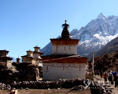
We are now in the region influenced by Buddhism. After a few more ups and downs through forests, the trail turns a corner and arrives at Ghap through an intricate wall of Mani stones (prayer walls) with well-preserved paintings and elegant mani walls. Look across the river for views of the village of Prok perched on the plateau above the river. We continue trekking through the humid forest of bamboos and rhododendrons. Before reaching Namrung, we make a steep climb to Namrung (2630m). It is a beautiful, typical village.

  • Accommodation Lodge
  • MealsBreakfast/Lunch/Dinner
  • Max Altitude2630m

The trail now enters the Nupri region. Typical Tibetan features include entrance gates to the villages, MANI walls, and Buddhist gompas. Beyond here, the valley opens up and soon passes through the Tibetan village of Sho. Above this village, we get views of Manaslu and Naike Peak, and from the next village of Lho, we see Ganesh I down the valley.

  • Accommodation Lodge
  • MealsBreakfast/Lunch/Dinner
  • Max Altitude3180m

With a gentle climb and a few meters of descents following the right bank of the river, offering views of Peak 29 ahead. After a couple of hours of climbing through the forest, we reach the village of Shyala, which offers superb views of Phungi, Manaslu, and Himal Chuli. From Shyala, we continue climbing toward Pung Gyan Gompa, at 3870 meters. This is a stunning walk up towards the Pung Gyan glacier, passing Tibetan 'kharkas' or seasonal herding settlements, with unbeatable views of Manaslu near the gompa. The gompa was mostly destroyed by an avalanche in 1953 and recently rebuilt. The complex includes a cave gompa as well, which affords even better views of the valley. After spending some hours surrounding the gompa and admiring the glacier, we trek downward to Samagaon. Walking through the wide pasture with many marmots. We stay tonight in a lodge with impressive views of Manaslu.

  • Accommodation Lodge
  • MealsBreakfast/Lunch/Dinner
  • Max Altitude3400m

Easy journey today, following the valley northwards to a bridge over a side stream where the trail forks: the left leading towards the Manaslu Base Camp, the other passing several mani walls heading for the Larkya La. The valley widens along an easy trail past juniper and birch forests to the stone huts at Kermo Kharka, then drops off a shelf to cross a wooden bridge and climb between a fork in the river to a promontory. From this vantage point, one can see the white stone kani marking the entrance to Samdo.

  • Accommodation Lodge
  • MealsBreakfast/Lunch/Dinner
  • Max Altitude3800m.

Rest day. Climb up to 4500m for acclimatization. Overnight in lodge.
We spend two nights at Samdo to aid acclimatization. There is a good day walk towards Gya La, the trading pass with Tibet.


  • Accommodation Lodge
  • MealsBreakfast/Lunch/Dinner
  • Max Altitude3800m

Today we start the ascent to the pass by descending through fields to an old mani wall and stone arch before dropping to the river and crossing on a wooden bridge.
This place shows up on maps as the mythical Larka Bazaar, which used to be a flourishing market, but there is nothing remaining there now from here the trail starts climbing through tundra and juniper; the huge Larkya Glacier coming from Manaslu can be seen from here. We reach Larkya Phedi ( Dharamsaala), where there is a small lodge, built to serve travellers crossing the Larkya La which lies now just ahead.

  • Accommodation Lodge
  • MealsBreakfast/Lunch/Dinner
  • Max Altitude4400m.

After an early start, we soon reach the ablation valley on the left side of the Larkya Glacier with impressive views of Cho Danda and Larkya Peak. We continue walking along glacial moraine and start making the gradual ascent to the Larkey pass. From the top, there is a panorama view of Himlung Himal, Cheo Himal, Kang Guru and Annapurna 2.
On the descent the trail follows the top of the moraine to the west and makes a set of steep, rough witchbacks as it crosses the moraine then descends more gently The trail now becomes easier to follow and reaches a small meadow and spring at 3800m. The valley becomes wider as the trails heads down to a large meadow to our camp site

  • Accommodation Lodge
  • MealsBreakfast/Lunch/Dinner
  • Max Altitude5200m/3800m

This morning the trail drops to a glacial stream at the headwaters of the Dudh Khola, crosses a wooden bridge and descends into pine and rhododendron forest. The trail continues through fields and intermittent stands of rhododendron and oak to arrive at Tilje, a large Gurung village.

  • Accommodation Lodge
  • MealsBreakfast/Lunch/Dinner
  • Max Altitude2300m.

We gradually trek down toward Dharapani where we joint the Annapurna classic circuit trail then treks towards Bagarchap, which is a Tibetan village from where we start to see impressive view of high summits: again Manaslu, Ngadichuli, Lamjung, Annapurna II.
We continue to trek gradually climb by the stunning path in the conifers forest (Pines of Himalayas). It is a pleasant journey in the conifers forest (Pines, firs, cedar.) with seizing the massive Manaslu and Lamjumg Himal. We find the first Rhododendrons (flourish in March/ April). Every entrance of the village consists of prayer wheels and flags, the smell of burnt juniper incense as offerings, which welcome us. The glaciers are more and more close and the temperature rapidly falls in the night.

  • Accommodation Lodge
  • MealsBreakfast/Lunch/Dinner
  • Max Altitude2700m.

Following along the Marsyangdi gorge through the pine forest and apple farm, cross the Marsyangdi river at the Swargadwari bridge. As the valley becomes more open, you will have a stunning view toward the east of the rocky cliff, which is believed to be the path to Heaven. To the northwest, you can see Pisang Peak and, further at the end of the valley, many more mountain peaks Chulu peak range etc... The atmosphere now feels like thin air and a desert plateau. The trail becomes a flat, wider road up to Pisang.
Our night will be spent at Upper Pisang, an ancient settlement perched beneath the mountain flank, with houses made of wood and muddy stones. Today's walk is about 15 km. Stroll around the village and visit the Gompa.

  • Accommodation Lodge
  • MealsBreakfast/Lunch/Dinner
  • Max Altitude3400m

Our journey starts by gently descending through open juniper bushes and cultivated fields. After a few hours of walking, you will face a steep climb of about 370m towards Gyaru (3670m), another settlement perched on the mountain flank. The climb rewards you with amazing views of the Annapurna II range and Lamjung Himal. After spending some time here, you will trek towards Ngawal along the mountain flank. Your lunch will be in a lodge here, one of the largest settlements in upper Manang.

After lunch, continue trekking to Manang. Before arriving at Manang, you can visit the Braga monastery and village, a magnificent Tibetan monastery perched on the village, typically Tibetan in style, constructed on the limestone hillock flank. After the visit, we proceed to Manang which is biggest and a beautiful village in the valley.


  • Accommodation Lodge
  • MealsBreakfast/Lunch/Dinner
  • Max Altitude3540m

Rest day,

  • Accommodation Lodge
  • MealsBreakfast/Lunch/Dinner
  • Max Altitude3540m

This is the one of the most beautiful parts of the Annapurna Circuit with majestic views on the way up of Gangapurna, Annapurna III and Chulu West. The route gets a bit steeper and the terrain more rugged. On the way up to Yak Kharta you will have chance to encounter the wild blue sheep and the domestic Yaks in the meadow.  If you are physically fit, you can continue upo Leddar that makes easier next day to go up Thorang Phedi High camp

  • Accommodation Lodge
  • MealsBreakfast/Lunch/Dinner
  • Max Altitude4000m.

Another short but strenuous day as we continue up the valley and cross the Jorsang Khola on a small cantilevered bridge before edging our way around loose screed slopes to finally reach a couple of ramshackle tea-shops at the foot of the awesome Thorong La. You will spend the night at Thorong Phedi which is probably the best option for a nights rest before crossing the pass in the morning. Its possible to continue another hour up to Thorong High Camp but the lodging is better in Thorong Phedi and staying lower longer probably makes sense in terms of avoiding altitude problems.

  • Accommodation Lodge
  • MealsBreakfast/Lunch/Dinner
  • Max Altitude4400m.

Today is the longest and hardest journey of the trek. The trail is quite steep between Thorong Phedi and Thorong High Camp. It's suggested to start early in the morning, around 4 am, in order to avoid the gusty winds that come up later in the day. While you climb, it will often seem like the pass is just behind the next ridge, only to find another ridge or moraine in the distance. When you finally reach the pass, you are rewarded with fantastic views in all directions. Don’t overlook the difficulty of getting down to Muktinath, which involves a fairly steep descent of about 1500m. In front of you are views of the Mustang Region and Dhaulagiri Mountain. You will certainly be tired from the long journey and the altitude, but you will forget this upon arrival in Muktinath.

You will visit the sacred Hindu temple, built in the early 19th century, dedicated to Vishnu and named Muktinath, Muktikshetra (place of liberation) is both religious symbiosis for Hindus and Buddhists devotees. The natural eternal flame inside the Gompa can be witness. The Muktinath temple is one of the most ancient temples of Lord Vishnu. The statue of the Muktinath temple Vishnu is enormous, made up of real gold, and is often compared with a tall man. The outer courtyard, known as the Parokrama, 108 sacred water flows through these bull-faced fountains. Pilgrims believe that bathing in the water from these 108 sacred fountains purifies their lives.

  • Accommodation Lodge
  • MealsBreakfast/Lunch/Dinner
  • Max Altitude3800m.

In the morning, after breakfast, we start our trek from Muktinath via Lubra village by walking a gentle uphill up to 4000m. You will have a magnificent view towards Nilgiri Himal and Dhaulagiri as well. Then we steeply descend to Lubra village, a hidden village in Mustang, the inhabitants of the village practice the Bon religion, and we can visit the Bon Bo monastery. Our path then leads to Jomsom through a graveled stones path, along the Kaligandaki river bank.

  • Accommodation Lodge
  • MealsBreakfast/Lunch/Dinner
  • Max Altitude2700m.

The flight is very impressive between the Annapurnas and Dhaulagiri.
(Jomsom weather is often uncertain, the flight either Jomsom  to Pokhara or Pokhara to Jomsom can be cancelled. In that case you may have travelled by road. The recent under construction road condition is quite narrow & gravelled between Jomsom and Beni. Some times you may need to change your vehicles several times causes landslides and other circumstances. (as well as the bumpy road may make your trip slightly bore.) 

  • Accommodation Hotel
  • MealsBreakfast/Lunch/Dinner
  • Max Altitude900m

We take a tourist bus and our journey starts from Pokhara to Kathmandu through Prithivi Highway. We take our lunch on the way.


  • Accommodation Hotel
  • MealsBreakfast/Lunch
  • Max Altitude1340m

free day for shopping and souvenirs.


  • Accommodation Hotel
  • MealsBreakfast
  • Max Altitude1340m

Transfer to airport. (Departure time from hotel will be fixed as per your flight schedules for the return


  • Accommodation plane
  • MealsBreakfast

Not satisfied with this regular itinerary?

Are you thinking to plan your custom trip now.

Included
  • Transfer:  Airport / Hotel pick up & drop by private car/van as per group size.
  • Transportation: Kathmandu/machhikhola traveling by private reserve jeep
  • Full board meals during the trekking, accommodation in twin sharing Lodges/tea house.  (Meals can be choose from lodge Menu) (Breakfast + tea/coffee, Lunch+tea/coffee, Dinner+tea/coffee.) (Cold drinks are not included nor hot drinks between three major meals)
  • An Experienced & Professional Government license holder English speaking trained Trekking guide.
  • Entry permit for Annapurna Conservation Area Project (ACAP), Entry permit for Manaslu Conservation Area Project (MCAP), You are required 2 passport size photos.
  • Special trekking permit for Manaslu
  • 4 nights in hotel International Guest House or Similar category on a twin sharing bed and
  • 1 night a tourist class hotel in Pokhara on BB
  • Flight fare Jomsom/Pokhara
  • First aid kit will be available during the trek.
  • Nepalese Staffs Insurance.


Excluded

All above items which are not mentioned in above cost included section. Hotel, Meals which are not your charge (Near about $ US 10 – 15 per day/person)
Nepal entry Visa Fee (You can obtain a visa easily upon your arrival at Nepal ’s Airport in Katmandu). You will require 2 passport size photos.
International Airfare and Airport Taxes.
Entrance fees in the Historical site /Monument at KTM.
Any kind of Alcoholic, hot and cold drinks or bar menu.
Personal trekking Equipment, travel and medical insurance & helicopter in case for emergency Rescue evacuation, personal expenses,
Any expenses caused by reason beyond our control such as roadblock due to natural climates and accidents and unforeseen events etc…
Tips and Gratitude.