Salt trade route of Lower Dolpo

Trip Facts
  • Duration 19 Days
  • Destination Nepal
  • Max Altitude 5200m.
  • Trip Start and End Kathmandu-Kathmandu
  • Best Season April-October
Highlights

Phoksundu Lake, Dho-Tarap, Nomad Life styles Shey Gumpa and monasteries, etc.

 Salt trade route of Lower Dolpo

This circuit is the shorter one in Lower Dolpo. This program will take you to the capital town Dho, of Lower Dolpo. It consists of two passes over 5000m, Numla and Bagala, and Shey Phoksundo Lake, which is the deepest Lake in Nepal, also lies inside the Shey Phoksundo National Park.

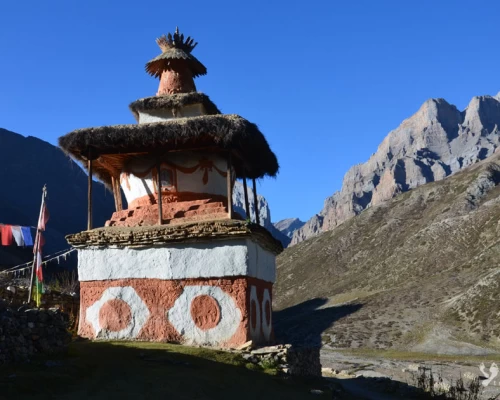
Dolpo region, which culturally and naturally resembles the Mustang region, lies on the direct route between Tibet and Nepal, where we cross the caravans of yaks carrying salt and wool from Tibet. It makes any trekkers feel the lifestyle of the mountainous region. It offers a highly adventurous journey where you get to feel the rhythm of chörtens, Buddhist prayer spots, and watch Blue Sheep, Snow Leopard, Rabbit, and Marmot in the Shey Phoksundo National Park

Itinerary

ExpandCollapse
  • Accommodation Hotel
  • MealsFree
  • Max Altitude1340m.
  • Accommodation Hotel
  • MealsB
  • Max Altitude1340m.

In the afternoon, there is a 1-hour flight to reach the Far-West of Nepal, Nepalgunj. The journey is quite remarkable, crossing the entire length of the Nepal Himalaya west of Kathmandu, offering superb views of Langtang, Manaslu, Annapurna, and Dhaulagiri. Nepalgunj is situated near the Indian border and is notably warmer compared to Kathmandu.

  • Accommodation Hotel
  • MealsBLD
  • Max Altitude100m

A 35-minute flight takes us to Juphal, where a landing on a steep mountain runway marks the beginning of our trek in the village of Juphal. After meeting the crew, we descend towards Dunai (2,090m), the administrative center of the Dolpo district. Upon reaching Dunai, we establish our camp near the village. The ethnic groups in this region are Brahmins and Tibetans, with the Brahmin civilization sharing similarities with that of the Tibetans.

  • Accommodation Camping
  • MealsBLD
  • Max Altitude2135m.

On the second day of the trek, we trace the course of the Bheri River. The day is relatively easy, involving crossings of suspension bridges. If time permits, we can explore the nearby villages and visit the monasteries, which are just a 30-minute walk from the campsite. The campsite is situated near the river.

  • Accommodation Camping
  • MealsBLD
  • Max Altitude2500m.

After approximately 2 hours of walking along the banks of the Bheri River, the trail takes a left turn at Khani Besi. From here, the path ascends gradually through the enchanting forest of Himalayan conifers. As you proceed, the surroundings transform into a serene landscape, surrounded by towering trees and the soothing sounds of nature. The trail meanders through the narrow valley carved by the river Dho.

The ascent through the Himalayan conifer forest provides a refreshing experience, with the crisp mountain air and the scent of pine filling the surroundings. The gradually climbing path allows you to immerse yourself in the natural beauty of the region, offering occasional glimpses of the river below.

As you continue your journey, the trail eventually leads to the picturesque Lahini, where the Dho River flows through the valley. The Dho-Taraf Camp at Lahini serves as a tranquil resting place, providing an opportunity to unwind and appreciate the pristine mountain environment. The campsite's location offers a blend of natural beauty and the comforting melody of the flowing river, creating a serene ambiance for a restful evening in the heart of the Himalayas.

  • Accommodation Camping
  • MealsBLD
  • Max Altitude2800m.

The ascent along the trail unfolds effortlessly as it winds through the valley, presenting a journey of gradual elevation gain. As you ascend, the air becomes infused with the invigorating scent of coniferous trees and juniper, creating an aromatic symphony that accompanies your every step. The trail leads you deeper into the heart of the mountains, where the landscape undergoes a captivating transformation.

  • Accommodation Camping
  • MealsBLD
  • Max Altitude3300m.

As the trail progresses, the valley undergoes a subtle transformation, spreading out into expansive plateaus that unveil a vast and open landscape. The once confined space now unfolds into panoramic vistas, offering a sense of grandeur as far as the eye can see. This expansion of the valley allows for unobstructed views of the surrounding mountains, creating a breathtaking tableau of nature's magnificence.

In the afternoon, a remarkable phenomenon unfolds—the river, which meanders through the valley, swells in size. This increase in volume is attributed to the melting snow, a dynamic process that brings life and energy to the landscape. The river, now transformed into a powerful force, resonates with the echoes of the thawing snow, creating a symphony of nature that reverberates through the open expanse of the valley.

  • Accommodation Camping
  • MealsBLD
  • Max Altitude4040m.

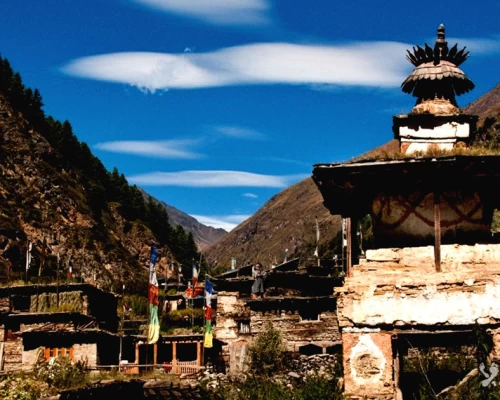
Dho is one of the larger villages nestled in the valley. The residents embody a pragmatic approach to life, influenced by their Tibetan cultural heritage and traditions. Having migrated from Tibet in times gone by, the village is adorned with several monasteries, reflecting the spiritual richness ingrained in their daily lives. However, despite the cultural wealth, the standard of living in Dho is notably modest.

The economic landscape in Dho is marked by challenges, with the locals engaging in agricultural practices as their primary means of sustenance. Due to the harsh terrain, they cultivate crops such as potatoes and black wheat, the latter being a hardy grain suited to the region's conditions. Notably, their agricultural activities are limited to a single cycle each year.

The villagers face economic constraints, compelling them to procure essential supplies from nearby towns such as Dunai or even Nepalgunj. The challenging terrain and limited resources contribute to a simple way of life in Dho.

A staple in their diet, potatoes constitute a significant portion of their meals. The reliance on this crop underscores the resourcefulness of the community in adapting to the local agricultural conditions. Despite the economic hardships, the people of Dho demonstrate resilience and a deep connection to their cultural roots, creating a community where tradition, practicality, and perseverance intertwine in the face of the challenging Himalayan environment.

  • Accommodation Camping
  • MealsBLD
  • Max Altitude4040m.

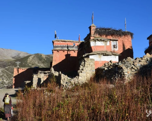
Traversing the elevated plateau provides a unique trekking experience, where every step unfolds a captivating panorama of the surrounding landscape. The trail winds its way through this high-altitude expanse, offering breathtaking views of the distant peaks and expansive valleys below. Amidst this serene journey, a series of villages and monasteries emerge, each bearing its own cultural charm.

As trekkers explore these villages and monasteries, the high plateau reveals not only its natural beauty but also the rich heritage and spirituality embedded in the mountainous terrain. The encounters with local communities and the sacred spaces provide a deeper appreciation for the harmonious coexistence of nature and culture in this elevated realm.


  • Accommodation Camping
  • MealsBLD
  • Max Altitude4700m.

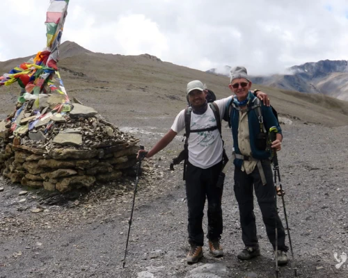
Embarking on our journey at the break of dawn, we set out to conquer the challenging Num-la Pass, standing tall at an elevation of 5200 meters. The early morning departure sets the tone for an awe-inspiring ascent, gradually navigating through the intricate terrain of the glacier. As we ascend, the world beneath us gradually transforms into a pristine wilderness, with each step revealing the raw beauty of the high-altitude landscape.

Upon reaching the pass of Num-la, a breathtaking panorama unfolds to the east. The majestic Dhaulagiri, soaring at an impressive 8167 meters, commands attention as it dominates the skyline. The view extends to encompass the formidable Mukut Himal, the imposing Manapathi, the distinctive Tukuche peak, and the graceful Sita Chuli. The spectacle of these towering peaks bathed in the morning light creates a surreal and humbling experience, highlighting the grandeur of the Himalayan range from this vantage point. Thereafter we descent to Bagla base camp

  • Accommodation Camping
  • MealsBLD
  • Max Altitude5200m./4500m

We crossing the second pass this trek (Baga Pass (5070m), the descent from the pass is challenging, covering a significant drop of 1500 meters, leading towards Yak Kharka. This descent marks the entry into the Shey Phoksundo National Park. The valley welcomes with lush vegetation, featuring dense forests of conifers, junipers, and Himalayan pine trees.


  • Accommodation Camping
  • MealsBLD
  • Max Altitude5070m/4500m

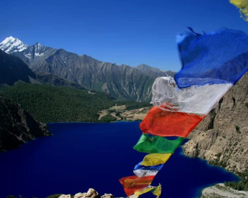
The afternoon stroll is gentle, allowing for a leisurely exploration of the mesmerizing Phoksundo Lake and a visit to the enchanting Ringmo Monastery. The azure expanse of Phoksundo Lake unfolds before you, creating a striking contrast against the backdrop of rust-red and earthy brown cliffs that encircle its shores. The visual interplay between the vibrant blue waters and the rugged cliffs forms a captivating spectacle, immersing you in the serene beauty of the natural surroundings.
As you amble along the lake's edge, you'll encounter the magnificent Ringmo Monastery, adding a spiritual dimension to the picturesque landscape. The monastery stands as a testament to the cultural and religious heritage of the region, offering a tranquil space for reflection amidst the breathtaking scenery.

The combination of the serene lake, the cultural richness of the monastery, and the natural wonders, including the waterfall, creates an immersive experience that captures the essence of the serene and diverse Himalayan environment.

  • Accommodation Camping
  • MealsBLD
  • Max Altitude3200m.

After breakfast, we commence our journey by traversing Ringmo village. Within half an hour of walking, we reach a viewpoint that offers a splendid vantage point to admire the majestic waterfall. Descending from the viewpoint, our path leads us to the riverside of Suligad Khola, where we continue our trek along the riverbank. The trail unfolds amidst the enchanting landscape adorned with Rhododendron, pine, bamboo forest, and other diverse flora.

  • Accommodation Camping
  • MealsBLD
  • Max Altitude2600m.

Finally, we reach the tropical climate vegetation, transitioning into the Suligad valley. Following the course of the Bheri River, we make our way up to Dunai. The ethnic communities in this region consist of Brahmins and Tibetans, with the Brahman civilization bearing a resemblance to that of the Tibetans. Returning from Dunai, we retrace the path taken on the first day of our journey.

  • Accommodation Lodge
  • MealsBLD
  • Max Altitude2400m.

Early in the morning for the flight from Juphal to Nepalgunj and onward to Kathmandu.

  • Accommodation Hotel
  • MealsBL
  • Max Altitude1340m
  • Accommodation Hotel
  • MealsB
  • Max Altitude1340m.
  • Accommodation Hotel
  • MealsB
  • Max Altitude1340m.
  • MealsB

Not satisfied with this regular itinerary?

Are you thinking to plan your custom trip now.

Included
  • Transfer:  Airport / Hotel pick up & drop by private car/van as per group size.
  • Flight Katmandu/Nepalgunj/dolpo/Nepalgunj/Katmandu.
  • Full board basis during the trekking in tent, camping equipment will be provided such as two-men tents, dining tent, foam mattresses, stools and all cooking and kitchen gear, meals will be prepared by our kitchen staff (Breakfast, Lunch, Dinner, Tea and coffee.), (Except beverage).
  • An Experienced & Professional Government license holder English speaking trained Trekking guide.
  • Trekking permit for lower Dolpo and Shey Phoksundo national park permit You are required 2 passport size photos.
  • 5 nights in hotel Manaslu at Katmandu or Similar category on a twin sharing bed and BB basis.
  • 1 night at tourist class hotel in Nepalgunj on twin sharing basis with breakfasts
  • First aid kit will be available during the trek.
  • All personal gears and group equipments will be carried by porter or yaks
  • Nepalese crews Insurance.
  • Domestic airport taxes.
Excluded
  • Meals in Katmandu (Near about $US 10 – 15 per day/person)
  • Nepal entry Visa Fee (You can obtain a visa easily upon your arrival at Nepal ’s Airport in Katmandu). You will require 2 passport size photos.
  • International Airfare and Airport Taxes.
  • Entrance fees in the Historical site /Monument at KTM.
  • Any kind of Alcoholic, hot and cold drinks or bar menu.
  • Personal trekking Equipment, travel and medical insurance & helicopter in case for emergency Rescue evacuation, personal expenses,
  • Any expenses caused by reason beyond our control such as roadblock due to natural climates and accidents and unforeseen events etc…
  • Tips and Gratitude.